
Secret Ravine is quiet most of the year and serious in a storm. Here is what Rocklin homeowners near the creek should know about hillside drainage, granite ground, and real flood risk.
A Creek Most Days, a Concern in a Storm
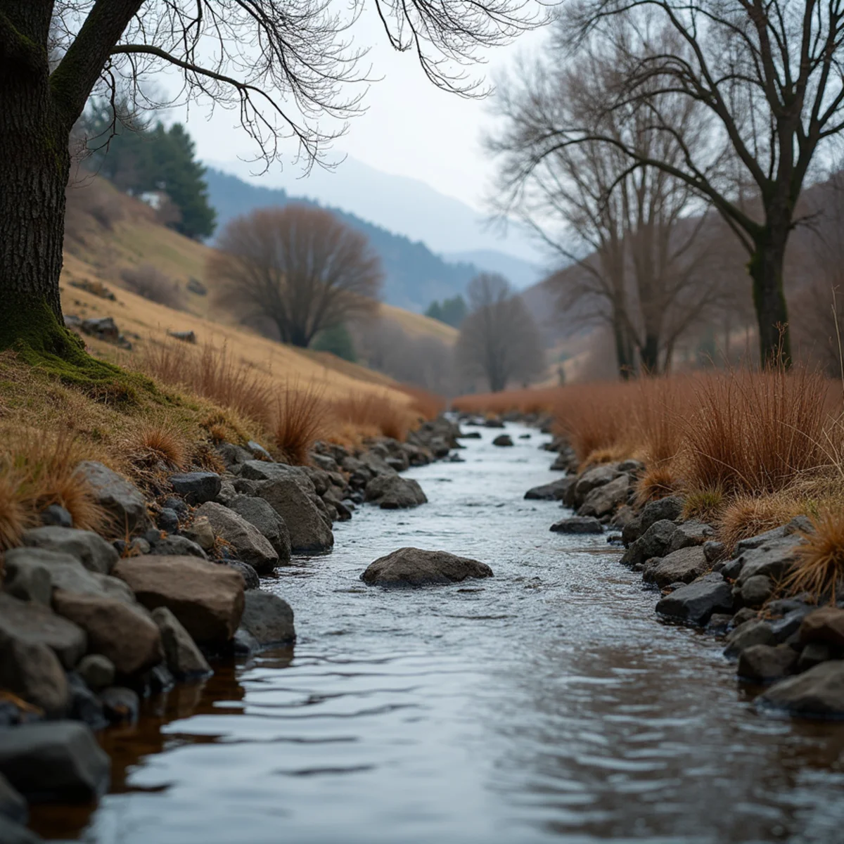
For most of the year, Secret Ravine is exactly what its name suggests — a quiet, tree-lined creek threading through Rocklin, easy to forget is there. It carries runoff and snowmelt down toward Dry Creek and eventually the Sacramento River. On an ordinary week it is a pleasant piece of the landscape. During a major winter storm, it is a drainage system doing serious work.
Secret Ravine is one of three watersheds — along with Antelope Creek and Dry Creek — that the Placer County Flood Control District actively manages. That management exists because these creeks can rise fast when an atmospheric river stalls over the foothills. Homeowners who live near the ravine benefit from understanding how it behaves before the rain arrives, not during.
The risk here is real but specific. It is worth knowing exactly what it is, and what it is not.
What Secret Ravine Is and How It Behaves
Secret Ravine is a natural drainage channel, not an engineered flood canal. It follows the contours of the land, collecting stormwater from a wide area of Rocklin and Roseville and funneling it downhill. In the dry months it may be nearly still. In a wet system it can go from a trickle to a fast, full channel within hours.
The creek's behavior is shaped by the ground it runs through. Rocklin sits on granite bedrock close to the surface in many areas — the same granite that built the town's quarry industry. Where bedrock is shallow, water cannot soak in; it runs off. That runoff has to go somewhere, and near the ravine, it goes to the ravine.
This is why properties close to the channel, and low spots that drain toward it, deserve more attention than a flat inland lot.
The Numbers: Who Actually Faces Flood Risk
It helps to be precise about the risk rather than alarmist. Flood analysis of the Secret Ravine corridor identifies roughly 61 properties with a minor level of flood risk over a 30-year period. That is a meaningful number for the households involved, but it is a defined, limited set — not the whole neighborhood, and not a catastrophic exposure for most homes near the water.
Placer County has a long documented flood history to draw on. The region has seen seven federal flood disaster declarations since 1964, and the January 1995 storm was estimated at around a 200-year event. Those are the extremes the drainage system is measured against. Most winters pass without incident; the planning is for the winters that do not.
If your property is among those with mapped risk, that knowledge is an advantage. It tells you where to focus your storm preparation and how quickly to act when water starts rising.
Why Granite Bedrock Changes Rocklin's Drainage
Granite is the defining feature of Rocklin's ground, and it changes how water moves here compared to a valley-floor town. Soil over shallow bedrock has limited capacity to absorb a downpour. When rain comes hard and fast, as it does during an atmospheric river, the ground saturates quickly and the excess sheets across the surface toward the lowest path.
That is both a benefit and a hazard. It means Rocklin drains efficiently in most storms. It also means that in an extreme event, water arrives at the creeks and low points faster than in more absorbent terrain. Hillside lots can see runoff cross their property from uphill, and homes near the ravine can watch the channel fill quickly.
Knowing your lot's relationship to the slope and the ravine is the foundation of protecting it.
Protecting a Home Near the Ravine
None of this requires major construction. Most of what protects a home near Secret Ravine is routine maintenance done before the rain rather than during it. The goal is simple: keep water moving away from the house and off the low points where it likes to collect, so an ordinary storm stays ordinary. If your lot carries mapped risk, it is also worth walking the property during the first real rain of the year to see exactly where the water wants to run.
You cannot control the ravine, but you can control how your property meets a storm. A few habits make the difference between a wet season and a water loss:
- Keep gutters, downspouts, and yard drains clear before November
- Grade soil and hardscape to carry water away from the foundation, not toward it
- Know the low points on your lot and where water pools first
- Have sandbags or barriers ready if your property is among the mapped-risk set
- Move stored valuables off garage and low-level floors during major storm warnings
Do You Need Flood Insurance Near Secret Ravine?
One practical question follows straight from the mapped-risk numbers: should you carry flood insurance? Standard homeowners policies exclude water that enters from outside, so a creek that rises into your home during a storm is generally not covered without a separate flood policy. For the roughly 61 properties along the Secret Ravine corridor with mapped minor flood risk, that separate coverage is worth a serious look, and some homes just outside the mapped lines choose it too, given how fast Rocklin's granite ground sends runoff to the low points.
The detail that catches people off guard is timing. A new flood policy typically carries a 30-day waiting period before it takes effect, so the week a storm is in the forecast is far too late to buy it. If your lot drains toward the ravine, that decision belongs in the dry season. An insurance agent or the Placer County Flood Control District can confirm where your property sits relative to the mapped risk.
Storm Season Help for Secret Ravine Homes
If you live along Secret Ravine, you already know the creek changes character when the rain sets in. The homes with the best outcomes are the ones ready before the first big system and quick to call when water gets inside. Stormwater is treated as potentially contaminated, and it usually reaches more of the house than expected.
Knowing your property's relationship to the creek changes how you experience the wet season. Instead of watching the forecast with vague worry, you know which storms matter, which low corner of the yard fills first, and how fast it clears. That awareness, more than anything, is what keeps a manageable storm from becoming a water loss — and it tells you when the situation has moved past do-it-yourself and it is time to make a call.
Our crews know this corridor and the way Rocklin's granite ground sheds water. When a winter storm sends water where it does not belong, call (201) 277-9344 for storm damage cleanup — extraction, drying, and restoration handled by a team that is already local.
Need help right now in Rocklin? Our line is open 24/7.
(201) 277-9344Frequently asked
Flood analysis identifies about 61 properties along the Secret Ravine corridor with a minor 30-year flood risk. Most nearby homes face limited exposure, but mapped-risk properties should prepare each winter.
Usually not. Water entering from outside during a storm is typically excluded from standard homeowners policies and covered by separate flood insurance. We help document the loss correctly regardless of coverage.
Granite bedrock sits close to the surface across much of Rocklin, so the soil absorbs less rain. Runoff sheets toward creeks and low points quickly during heavy storms. Call (201) 277-9344 if it reaches your home.
The Placer County Flood Control District and FEMA flood maps show where mapped flood risk falls, and an insurance agent can look up your specific address. Roughly 61 properties along the corridor carry a minor 30-year risk. Knowing your status tells you how hard to prepare each winter.
During an atmospheric river the creek can go from a trickle to a fast, full channel within hours, not days. That speed is why mapped-risk homes should have barriers ready before the storm arrives. If water gets inside, call (201) 277-9344 for extraction and drying.
Related help from our team
Restoration Rocklin CA
IICRC-Certified Water Damage Restoration Team
We're a locally based, IICRC-certified water damage restoration team serving Rocklin and Placer County 24/7. Questions about your situation? Call (201) 277-9344.